About VGDS
Geography
A riverine landscape stretching from Sultanganj to Kahalgaon along the Ganga.
The River Landscape
A Living Stretch of the Ganga
The sanctuary occupies a stretch of the Ganga near Bhagalpur, Bihar, running approximately from Sultanganj in the west to Kahalgaon in the east. Within this stretch, the river's channels, sandbanks, backwaters and confluence points create the varied riverine habitat that dolphins, gharials, otters, turtles and water birds depend on.
River geography in this stretch changes with the seasons — flow, depth and sandbank formation shift between the monsoon and drier months, which in turn shapes wildlife movement and the visitor experience through the year.
Detailed topographic and hydrological data are managed by the Forest Department and will be published here as official records become available.
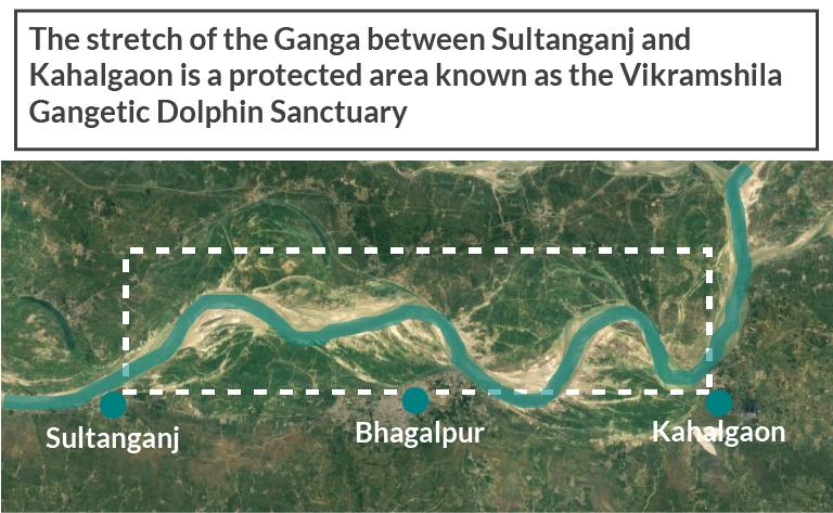
Sultanganj
Western boundary point of the sanctuary stretch.
Bhagalpur
Central city along the stretch and divisional headquarters.
Kahalgaon
Eastern boundary point of the sanctuary stretch.